Drones for Topographic Survey?
With the way that we capture geospatial data continuously advancing, we take a look at a recent survey undertaken by drone to see how It compares to more traditional forms of survey.
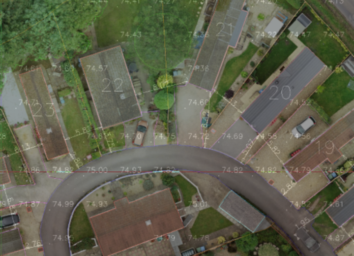
The case we will look at is that of a topographic survey of a static mobile home site carried out to ensure the park met specific local planning requirements for the layout of such areas:
- Every caravan should be not less than 6 metres from any other caravan and no less than 2 metres from a road.
- Where there are ramps for the disabled, verandas and stairs extending from the unit, there should be 4.5m clear spaces between them.
- Roads should not be less than 3.7 metres wide, or, if they form part of a clearly marked one way traffic system, 3 metres wide.
- Gateways should be a minimum of 3.1 metres wide and have a minimum height clearance of 3.7 metres. Footpaths should not be less than 0.75 metres wide. Roads should have no overhead cable less than 4.5 metres above the ground.
- Fire points should be established so that no caravan or site building is more than 30 metres from a fire point.
- Accurately measure the usable area and ensuring that gross density should not exceed 50 caravans to the hectare.
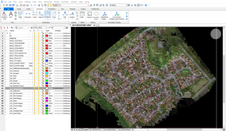
The survey was carried out utilising a drone which captures spatial data using photogrammetry techniques. From this data a CAD drawing could then be created detailing the site plan and dimensions. The drone was able to cover the area very quickly with the survey taking just 1 day. With the site being 9.28 hectares it was estimated that a single terrestrial based surveyor would take 4 days to complete this survey, therefore creating considerable savings in terms of site time. Additional benefits included the elimination of specific access requirements to the individual plots, reducing any disruption on site.
This is an ideal use of a drone survey to capture spatial data as the requirements fit well within the limitations of surveying with drones in terms of accuracy. Warner Surveys are one of the few companies to have enhanced permissions from the CAA allowing us to take off within 10 meters of Person, Vessel, Vehicle or Structure (PVVS) out with our control, especially useful in more densely urbanised areas.
For many sites that require more detail it is common to use a hybrid of survey techniques, using a drone where appropriate and using high accuracy GPS and total stations in more conventional survey techniques where the details are critical. This ensures the integrity of the survey data set, whilst drones alone are not suitable for all surveys, they are becoming more and more a part of the surveyors tool kit.
Project Facts and Figures:
- Survey area: 9.28 hectares
- 1 day on site
- 75% site time saved using Drone Technology
- 2D CAD deliverable
Additional deliverables over and above standard topo:
- Rectified aerial image for the park to use in marketing, etc
- 3D point cloud can be generated for alternate use, eg, flood analysis
For more information you can get in touch with Operations Director, Clif Webb